Earthquake seismologist launches international study of oceanic plate
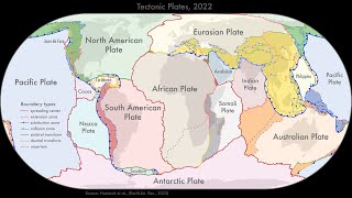
Northern Arizona UniversityFind out how an NAU team, led by professor Jim Gaherty, will conduct a seismological study of the Cocos tectonic plate deep beneath the Pacific Ocean.

Find out how an NAU team, led by professor Jim Gaherty, will conduct a seismological study of the Cocos tectonic plate deep beneath the Pacific Ocean.

A novel AI-based approach to detect earthquakes early uses prompt elasto-gravity signals, or PEGS, gravitational changes generated by large-mass motion in megaquakes. PEGS carry information about an ongoing earthquake at the speed of light, arriving much faster than even the fastest seismic waves.
New models that show how the continents were assembled are providing fresh insights into the history of the Earth and will help provide a better understanding of natural hazards like earthquakes and volcanoes.

Today, the Salton Sea is an eerie place. Its mirror-like surface belies the toxic stew within. Fish skeletons line its shores and the ruins of a once thriving vacation playground is a reminder of better days.
The 2004 Sumatra earthquake generated one of the most destructive tsunamis ever recorded, with 100-foot waves that killed nearly 230,000 and resulted in an estimated $10 billion in damage.

A new method of detecting mega earthquakes, which picks up on the gravity waves they generate by using deep-learning models created at Los Alamos National Laboratory, can estimate earthquake magnitude in real time and provide earlier warning of tsunamis.

During the 20th century, earthquakes in Europe accounted for more than 200,000 deaths and over 250 billion Euros in losses.
The 2016 Kumamoto earthquakes shocked inhabitants of the western island of Kyushu, causing hundreds of casualties and serious damage to vital infrastructure.
The 12 August 2021 South Sandwich Island earthquake had a surprise hidden within its complex rupture sequence: a slow, shallow magnitude 8.16 subevent that was “invisible” to researchers at first glance.

Tiny zircons found in South Africa point to an early start for the active global process that shapes Earth’s surface and climate.
In disaster mitigation planning for future large earthquakes, seismic ground motion predictions are a crucial part of early warning systems and seismic hazard mapping.
Volcanoes can be found even off the coast of Antarctica. At the deep-sea volcano Orca, which has been inactive for a long time, a sequence of more than 85,000 earthquakes was registered in 2020, a swarm quake that reached proportions not previously observed for this region.

Earthquakes are famously impossible to predict, and have been the cause of some of the most devastating events in human history. But could we learn more about these natural disasters by tracking them backwards through time?
Earthquakes themselves affect the movement of Earth's tectonic plates, which in turn could impact on future earthquakes, according to new research from the University of Copenhagen.

By examining earthquake models from a fresh perspective, Cornell University engineers now show that the earthquake fracture energy – once thought to relate to how faults in the Earth’s crust weaken – is related to how quakes stop.

Researchers from the Oden Institute for Computational Engineering and Sciences and Institute for Geophysics are part of a team developing Science Monitoring and Reliable Telecommunications (SMART) Cables, which will consist of sensors that “piggyback” on the infrastructure of the existing and expanding undersea telecommunications network. The sensors will allow for low-cost global deep ocean observation to detect temperature, pressure, and seismic acceleration.
University of Utah researchers know well how rock towers and arches shimmy, twist and sway in response to far-off earthquakes, wind and even ocean waves. Their latest research compiles a first-of-its-kind dataset to show that the dynamic properties, i.e. the frequencies at which the rocks vibrate and the ways they deform during that vibration, can be largely predicted using the same mathematics that describe how beams in built structures resonate.

While the aftermath of an undersea volcanic eruption and the following tsunami garner much attention as the waves crash around inhabited islands, an expert at West Virginia University says the combination of those hard to predict eruptions and climate change will eventually erase island nations and their cultures in the Pacific and western Indian oceans.
The Matterhorn appears as an immovable, massive mountain. A study shows that this impression is wrong. The Matterhorn is instead constantly in motion, swaying gently back and forth about once every two seconds.

A machine-learning approach developed for sparse data reliably predicts fault slip in laboratory earthquakes and could be key to predicting fault slip and potentially earthquakes in the field.
Since the tsunami that devastated coasts around the Indian Ocean in December 2004 and the Fukushima disaster in March 2011, people worldwide are aware that geological processes in the ocean can cause significant damage.

Researchers at Los Alamos National Laboratory are applying machine learning algorithms to help interpret massive amounts of ground deformation data collected with Interferometric Synthetic Aperture Radar (InSAR) satellites; the new algorithms will improve earthquake detection.
Esteban Gazel and doctoral student Kyle Dayton will join a small, elite team of international researchers on Oct. 21 at the newly erupted Cumbre Vieja volcano on the island of La Palma in the Canary Islands – off the coast of western Africa.

Multidisciplinary team of materials physicists and geophysicists combine theoretical predictions, simulations, and seismic tomography to find spin transition in the Earth’s mantle. Their findings will improve understanding of the Earth’s interior, and help elucidate the impact of this phenomenon on tectonic events including volcanic eruptions and earthquakes.

Recent research into the way cracks in the earth’s crust open and close along the San Andreas Fault has yielded a new way of studying earthquake behavior that bridges an important gap between laboratory experiments and earth observations, demonstrating a new way to study upper crustal behavior.

Scientists at Los Alamos National Laboratory have developed a method to determine the orientation of mechanical stress in the earth’s crust without relying on data from earthquakes or drilling.
Cornell professor and collaborators collect data that could provide new insight into the mechanics of crustal faults and possibly help researchers understand and anticipate future earthquake clusters.
The Codex Telleriano Remensis, created in the 16th century in Mexico, depicts earthquakes in pictograms that are the first written evidence of earthquakes in the Americas in pre-Hispanic times, according to a pair of researchers who have systematically studied the country’s historical earthquakes.
Wind power has experienced fast growth within China during the past decade, but many wind farms are being built within regions of high seismic activity. In Journal of Renewable and Sustainable Energy, researchers present their work exploring the dynamic behaviors of wind turbines subjected to combined wind-earthquake loading. The group discovered that changes in the wind increase and decrease the response amplitude of the wind turbine under weak and strong earthquakes, respectively.
New funding will support research to close a knowledge gap that disaster relief inspection teams often face in the field due to resource constraints.
Expert Q&A: Do breakthrough cases mean we will soon need COVID boosters? The extremely contagious Delta variant continues to spread, prompting mask mandates, proof of vaccination, and other measures. Media invited to ask the experts about these and related topics.
Earthquakes shake and rattle the world every day.
NBC Sports will air a documentary about the boat Kamome, a small boat ripped from Japan in the March 2011 tsunami that beached in California’s northern Del Norte County two years later, as part of their Olympic Games coverage on Sunday, August 1st at 9 a.m. on NBC stations throughout the country.
A major upgrade to the world’s largest outdoor earthquake simulator reached a milestone mid-April when the facility’s floor--all 300,000 lbs of it--was put back into place. When completed this fall, the simulator will have the ability to reproduce multi-dimensional earthquake motions with unprecedented accuracy to make structures and their residents safer during strong shakes. Researchers lay out the details of the upgrade in a paper published recently in Frontiers in Built Environment.
The cause of Earth's deepest earthquakes has been a mystery to science for more than a century, but a team of Carnegie scientists may have cracked the case.
Geoscientists at the University of Toronto (U of T) and Istanbul Technical University have discovered a new process in plate tectonics which shows that tremendous damage occurs to areas of Earth's crust long before it should be geologically altered by known plate-boundary processes, highlighting the need to amend current understandings of the planet's tectonic cycle.
The U.S. Geological Survey, the University of Washington-based Pacific Northwest Seismic Network, and state emergency managers on Tuesday, May 4, will activate the system that sends earthquake early warnings throughout Washington state. This completes the rollout of ShakeAlert, an automated system that gives people living in Washington, Oregon and California advance warning of incoming earthquakes.
A University of California San Diego engineering professor has solved one of the biggest mysteries in geophysics: What causes deep-focus earthquakes? These mysterious earthquakes originate between 400 and 700 kilometers below the surface of the Earth and have been recorded with magnitudes up to 8.3 on the Richter scale.
A new machine-learning model that generates realistic seismic waveforms will reduce manual labor and improve earthquake detection, according to a study published recently in JGR Solid Earth.
When hydraulic fracturing operations ground to a halt last spring in the Kiskatinaw area of British Columbia, researchers expected seismic quiescence in the region.
Boston College seismologist John Ebel and his colleagues have noted a pattern for some large California earthquakes: magnitude 4 or larger earthquakes occur at a higher rate along a fault in the two decades or more prior to a magnitude 6.7 or larger earthquake on the fault.
Tsunamis pose a real threat to the California coast, even if the triggering earthquakes occur elsewhere. CSU researchers are helping ensure coastal cities are ready.
In 1958, a magnitude 7.8 earthquake triggered a rockslide into Southeast Alaska's Lituya Bay, creating a tsunami that ran 1,700 feet up a mountainside before racing out to sea.
Geoscientists at Sandia National Laboratories used 3D-printed rocks and an advanced, large-scale computer model of past earthquakes to understand and prevent earthquakes triggered by energy exploration.