Geologists are interested in the sedimentary cycle – erosion from mountains that forms sand that is carried out to the ocean – because it’s foundational for understanding how the planet works.
Cornell University researchers have unearthed precise, microscopic clues to where magma is stored, offering a way to better assess the risk of volcanic eruptions.
Ongoing climate change driven by greenhouse gas emissions is often discussed in terms of global average warming. For example, the landmark Paris Agreement seeks to limit global warming to 1.5 ⁰C, relative to pre-industrial levels. However, the extent of future warming will not be the same throughout the planet. One of the clearest regional differences in climate change is the faster warming over land than sea. This “terrestrial amplification” of future warming has real-world implications for understanding and dealing with climate change.
“A combination of geological interpretations and thermal-orbital evolution models implies that Charon had a subsurface liquid ocean that eventually froze,” said SwRI’s Dr. Alyssa Rhoden, a specialist in the geophysics of icy satellites, particularly those containing oceans, and the evolution of giant planet satellite systems.
University of Miami College of Engineering faculty members Nurcin Celik and Derin Ural lived through the 1999 temblor that struck near the Turkish city of Izmit. They stand ready to offer their expertise in the aftermath of Monday’s disaster.
Scientists have discovered a new layer of partly molten rock under the Earth’s crust that might help settle a long-standing debate about how tectonic plates move.
Scientists discovered the first-ever Dickinsonia fossil in India two years ago, changing our understanding of how the continent came to be. Now, new research shows the "fossil" was just a beehive all along, changing our understanding for a second time, and the original scientists now support the new findings.
A chemical engineer developing more environmentally friendly materials and a geologist exploring the chemistry of Earth’s carbon reservoirs are the latest Florida State University faculty members to be named Fellows by the American Association for the Advancement of Science, or AAAS.
The Latest Permian Mass Extinction (LPME) was the largest extinction in Earth’s history to date, killing between 80-90% of life on the planet, though finding definitive evidence for what caused the dramatic changes in climate has eluded experts.
In their new paper for the Geological Society of America journal Geology, Dulcinea Groff and colleagues used radiocarbon ages (kill dates) of previously ice-entombed dead black mosses to reveal that glaciers advanced during three distinct phases in the northern Antarctic Peninsula over the past 1,500 years.
Current models of sea level rise suggest the most widespread impacts will occur after sea level has risen by several meters. But a new study finds the biggest increases in inundation will occur after the first 2 meters (6.6 feet) of sea level rise, covering more than twice as much land as older elevation models predicted.
A team of researchers led by Brian Yellen, research professor of earth, geographic, and climate sciences at the University of Massachusetts Amherst, recently announced in the Journal of Geophysical Research: Earth Surface that salt marshes, critical habitats threatened by rapid sea-level rise, may in fact thrive despite higher water levels.
Nearly 100 million years ago, the Earth experienced an extreme environmental disruption that choked oxygen from the oceans and led to elevated marine extinction levels that affected the entire globe.
When the rigid plates that make up the Earth’s lithosphere brush against one another, they often form visible boundaries, known as faults, on the planet’s surface. Strike-slip faults, such as the San Andreas Fault in California or the Denali Fault in Alaska, are among the most well-known and capable of seriously powerful seismic activity.
The emergence of plate tectonics in the late 1960s led to a paradigm shift from fixism to mobilism of global tectonics, providing a unifying context for the previously disparate disciplines of Earth science.
The Martian meteorite Tissint contains a huge diversity of organic compounds, found an international team of researchers led by Technical University of Munich and Helmholtz Munich’s Philippe Schmitt-Kopplin and including Carnegie’s Andrew Steele.
Cornell College Professor Rhawn Denniston and a team of collaborators have combined stalagmites and climate model simulations to reveal links between monsoon rains and tropical cyclones (called hurricanes in the U.S.) in Australia.
The discovery of hydrous ringwoodite inclusion in diamonds with 1.5 wt.% H2O by Pearson et al. in 2014, provided an irrefutable indication that water is present in the Earth’s deep mantle.
Taxonomists are working against the clock to discover and catalogue new species before they disappear, to make it possible to protect our planet's remaining biodiversity.
Immanuel Kant Baltic Federal University scientists demonstrated that atmospheric wave processes can be calculated by device registered Earth surface atmospheric pressure fluctuations.
The combination of global atmospheric warming and westerly winds shifting toward the poles will likely speed up the recession of mountain glaciers in both hemispheres, according to a UMaine study.
Dos artículos científicos publicados recientemente muestran cómo estos telescopios están ayudando a la comunidad científica a conocer mejor el planeta más grande de nuestro sistema solar, Júpiter, y su luna más cercana, Io.
The Virtual Field Geology project has many goals: to make geology field experiences accessible to more people; to document geological field sites that may be at risk from erosion or development, to offer virtual “dry run” experiences and to allow scientific collaborators to do virtual visits to a field site together. While the pandemic brought new urgency to the project, its developers believe it’s part of a “new normal” for geology research and education.
The biochemical process by which cyanobacteria acquire nutrients from rocks in Chile’s Atacama Desert has inspired engineers at the University of California, Irvine to think of new ways microbes might help humans build colonies on the moon and Mars.
KICT and Deltares conducted a research on prediction of the future changes in river landscapes using an eco-morphodynamic model applied to an actual river. According to the study result, the vegetation cover increases continuously until 2031, and the area covered by willow trees occupies up to 20% of the river area.
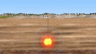
Louis Urtecho and his team hope to study dust devils in the Mojave Desert on Earth, then extend the analysis to scale for the different atmosphere on Mars. Based on microbarometer data from the Mojave, they built an algorithm to look for the pressure activity indicative of a dust devil. The vortices have a distinct drop in pressure near their centers, and their pressure fluctuates to look like an electrocardiogram signal over time. The team hopes to learn more about the convective vortices and how they move, which will improve the accuracy of Martian weather models.
In Physics of Fluids, researchers have been studying the dynamics of how crescent-shaped sand dunes are formed. Known as barchans, these formations are commonly found in various sizes and circumstances, on Earth and on Mars. Using a computational fluid dynamics approach, the team carried out simulations by applying the equations of motion to each grain in a pile being deformed by a fluid flow, showing the ranges of values for the proper computation of barchan dunes down to the grain scale.
A year before the largest active volcano in the world erupted, research by two University of Miami scientists revealed which of the two rift zones of the Mauna Loa volcano would spew magma.
By: Bill Wellock | Published: December 2, 2022 | 11:55 am | SHARE: The Hawaiian volcano Mauna Loa, the largest active volcano on the planet, is erupting for the first time since 1984.Vincent Salters, director of the Geochemistry Program at the National High Magnetic Field Laboratory at Florida State University, is available to speak to media about the geology behind this eruption.
Min Chen was an assistant professor at MSU in the Department of Computational Mathematics, Science and Engineering and the Department of Earth and Environmental Sciences in the College of Natural Science. Using the power of supercomputing, Chen developed the method applied to Maguire’s images to model more accurately how seismic waves propagate through the Earth. Chen’s creativity and skill brought those images into sharper focus, revealing more information about the amount of molten magma under Yellowstone’s volcano.
One of Australia’s most captivating landscapes can now be explored virtually, thanks to a University of South Australia project that documents the geological and cultural significance of the Flinders Ranges.
Satellite observations have revealed that weak seismic ground shaking can trigger powerful landslide acceleration – even several years after a significant earthquake.
A recent study co-authored by associate professor Matthew Bowker found important connections between grazing pressure on drylands and the ecosystem services they provide.